Grid Mapping advanced kit
Mapping strategies 
The following strategies outline different approaches to extending the existing transmission network. In general, the larger the tower and substation, the higher the voltage and therefore the greater the importance to the network. Priority should therefore be given to large, high-voltage infrastructure first. The easiest way to start mapping the transmission network is to find the location of new 'towers'. You can hardly go wrong with this and it will help you to familiarise yourself with the tool and the local network. Only map infrastructure that you can confidently classify using satellite or ground imagery.
 Search for all "Unfinished power lines" in Osmose and check if you are able to find new towers at the end of the line. See the tools section.
Check if windparks, solar farms, and power plants are connected to the transmission grid. The GEM per Country tool helps you to create a geojson file of all the power plants in a country.
Ensure all transmission substations are connected to the grid.
Check for news reports on new substations and transmission lines that have become operational in recent years. LLMs like ChatGPT allow you to search in the local language: "Please search for news about transmission lines or substation recently opened in country A. Please use the official language of the country for your search".
Search for new substation records and national substation records as a reference "hint" layer. LLMs like ChatGPT allow you to search in the local language: "Please search for transmission lines or substation datasets in X. Please use the official language of the country for your search." For a curated list of datasets that may be useful, see Awesome Electric Grid Mapping List.
Map fast 
If you want to be able to fast efficiently and fast, you will need to know how to correctly place towers and power lines. This will save you loads of time:
1. Draw nodes (A) on towers as you follow the towers. This will create a long line of untagged nodes, all connected by a untagged way.
2. Click on the way, and select power line to tag it.
3. Then press on the way again, and control+F to open up search. Then paste in the bar: child selected type:node AND untagged
This will select all untagged nodes of the way.
4. Then you can tag all the selected nodes as towers in one go.
Downloading transmission data of an area near a border 
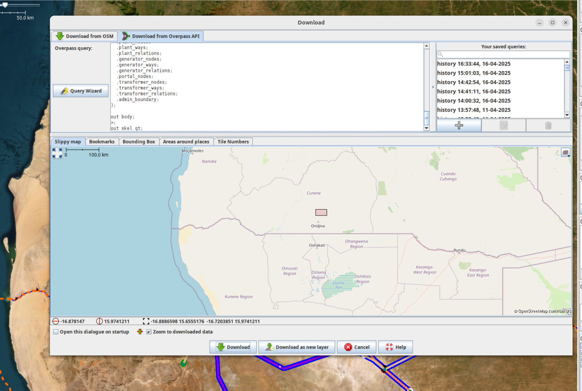
If you are mapping an interconnector between two countries for example, and you want to see if it is mapped on the "other" side of the border. You can either do a quick Download from OSM in a new layer and see. Or you can use the following overpass query:
1. Copy this query, and paste it in Download from Overpass API.
2. Then draw a small bounding box in the slippy map, and download.
 Explanation: The query looks for nodes in the bounding box, finds the admin area of the nodes, and then fetches all power infrastructure in the area. The query is set at admin level 4 (state/region), but can be changed to national (level 2), or to a province (level 6).
For that you will have to change the query in the downoad tab, by switching the admin level. Technically, if there are 0 nodes (unlikely) in your bounding box, then it won't work. A small bounding box suffices (and is better as the query execution is faster).
Bing attribution issue 
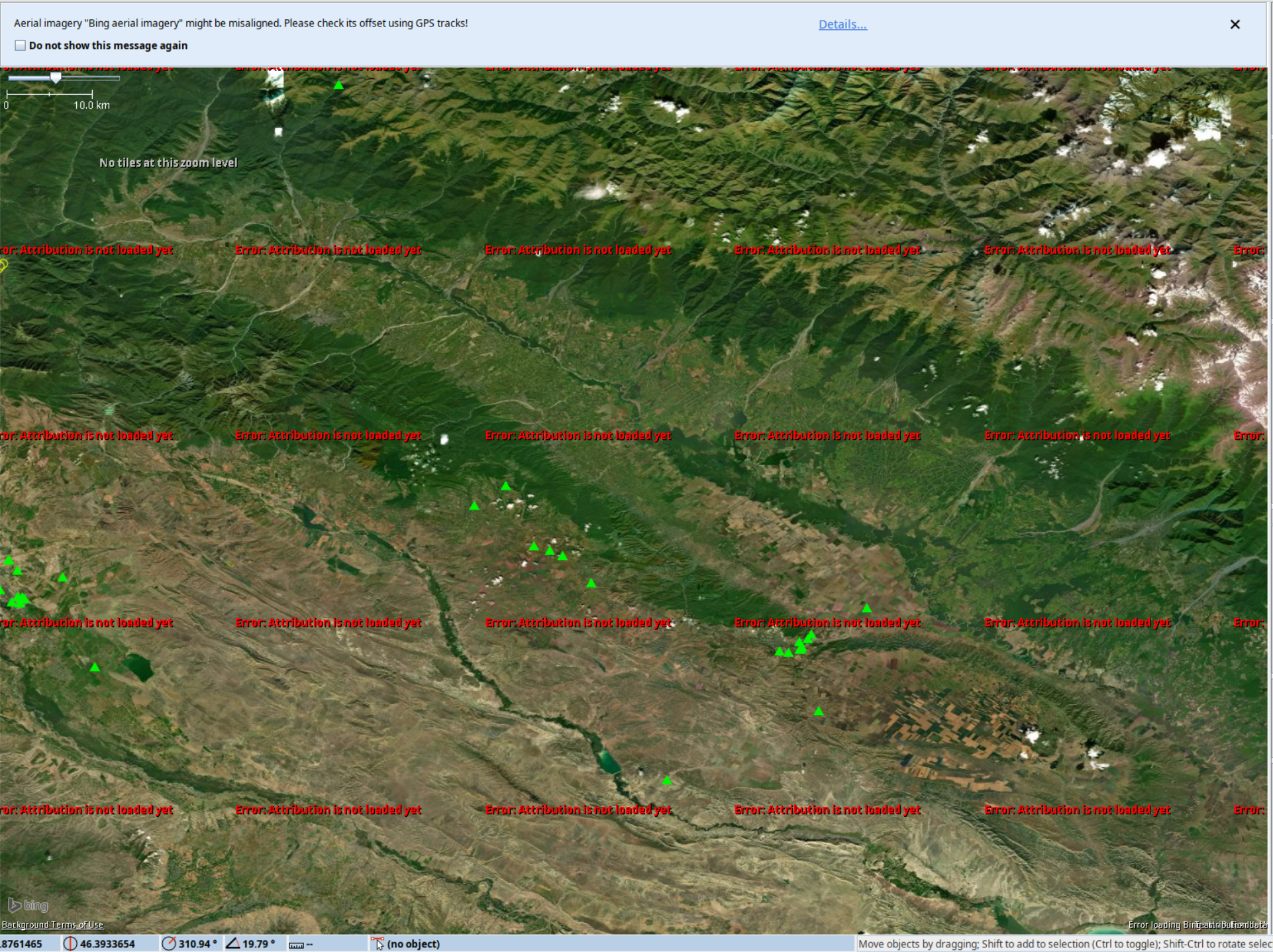
At the moment, there seems to be an issue with Bing attribution where it only seems to load in the mornings (CET). However, you can work around that for the time being using this little trick.
1. On a day where bing is working for you, copy and save the bing.attribution.xml file in another personal folder somewhere on your device.
On Windows, this is in Appdata>Roaming>JOSM
On Linux, it can be found in .cache>JOSM
2. On the day where it is not working, just go this folder and replace the bing.attribution.xml file with the one saved from the previous day. You might have to reload JOSM.